Why Does My Community Have Brown Water?
Complete guide to wastewater discharge permits in Colorado. Understand CDPHE requirements, avoid violations, and streamline your permit application today
Colorado’s Wastewater Discharge Permit Rules: What Communities Need to Know
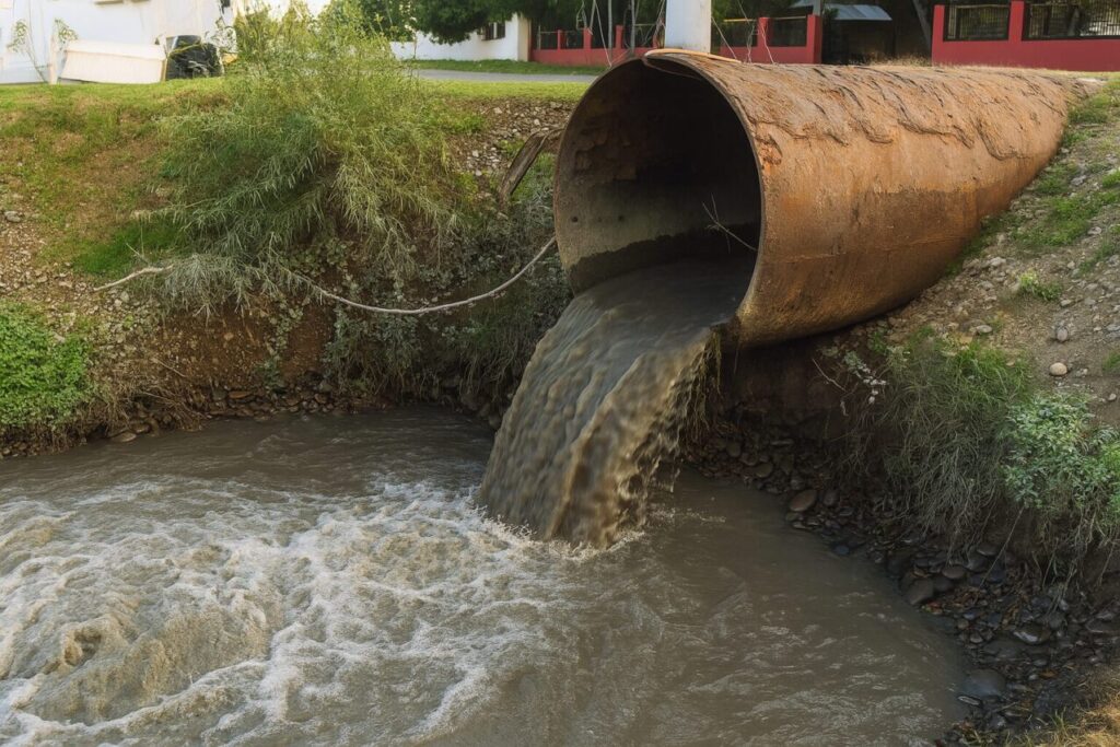
Complete guide to wastewater discharge permits in Colorado. Understand CDPHE requirements, avoid violations, and streamline your permit application today
What You Should Know About Rainwater Collection Systems for Texas Communities
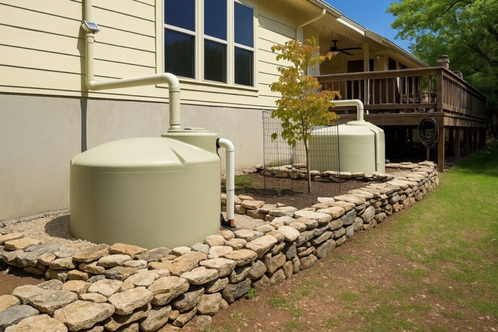
Marble Falls, Big Spring, and El Paso have something in common – they stopped treating their water systems like three different problems. One Water means connecting what used to be separate: the drinking water plant, the wastewater plant, and stormwater management all work together now.
Understanding Your Community’s Wastewater Collection System
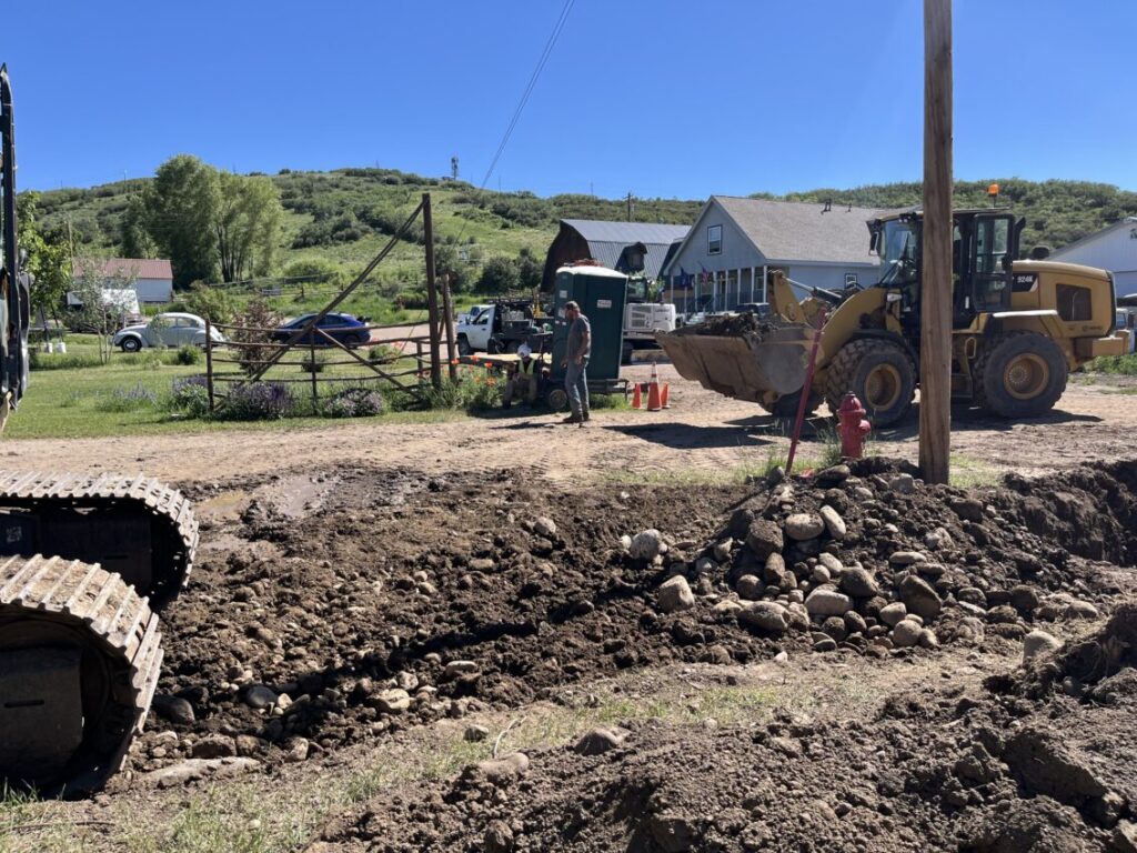
In today’s world, protecting water resources is more critical than ever. At the heart of this mission are environmental engineers, the professionals who design, implement, and refine systems that manage wastewater safely and sustainably. Their work not only protects public health but also preserves the environment for future generations.
Texas Governor Opens $22.5 Billion Water Fund For Wastewater Developers
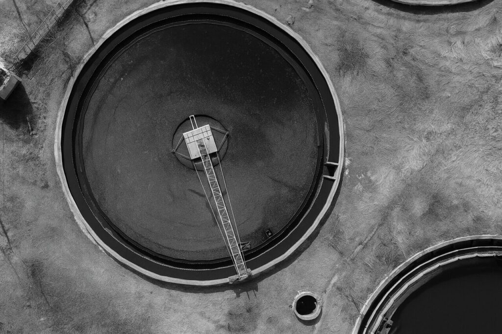
Texas wastewater permitting requires developers to obtain TCEQ approval before constructing or operating wastewater treatment facilities. The process involves three main permit types: TPDES (surface water discharge), TLAP (land application), and Chapter 210 (reclaimed water reuse).
Texas Wastewater Permitting Guide For Developer
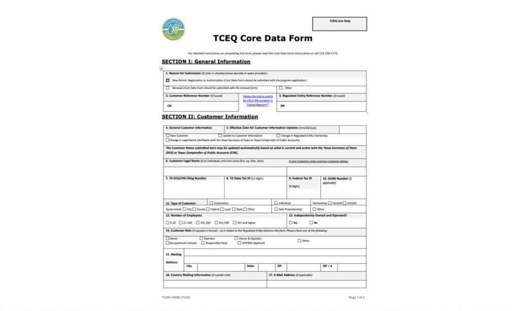
Texas wastewater permitting requires developers to obtain TCEQ approval before constructing or operating wastewater treatment facilities. The process involves three main permit types: TPDES (surface water discharge), TLAP (land application), and Chapter 210 (reclaimed water reuse).
How We Use Microsoft Apps to Accelerate Your Civil Engineering Project Success

Let’s face it – civil engineering projects are messy. There are dozens of people involved, mountains of paperwork, and strict deadlines that never seem to move. Many engineering firms are finding that Microsoft’s apps can cut through this chaos and make projects run smoother. Here’s how they’re doing it.
Understanding Water System Design Quotes: What You’re Really Paying For

When developers receive proposals for water system design, they’re often confronted with surprisingly wide price variations—sometimes differing by a factor of ten. We recently spoke with a developer who had received quotes ranging from $10,000 to $100,000 for what appeared to be the same scope of work.
Managing Colorado’s Aging Water Infrastructure Using Key Strategies
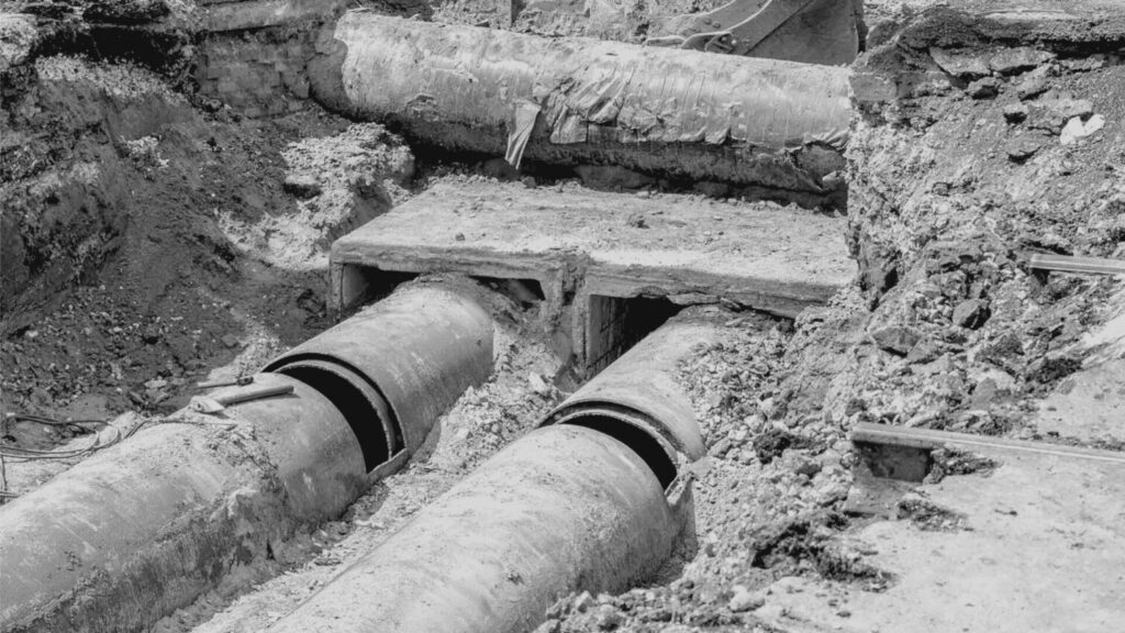
In communities across America, water infrastructure installed during the Johnson and Nixon administrations continues to serve as the backbone of local water supply systems.
Public Water System Design and Implementation in Texas

Designing a new public water system in Texas requires a careful balance of hydraulic design, regulatory compliance, and construction best practices.
What Is Water and Wastewater Engineering?

In today’s world, protecting water resources is more critical than ever. At the heart of this mission are environmental engineers, the professionals who design, implement, and refine systems that manage wastewater safely and sustainably. Their work not only protects public health but also preserves the environment for future generations.
The Role of Environmental Engineers in the Wastewater
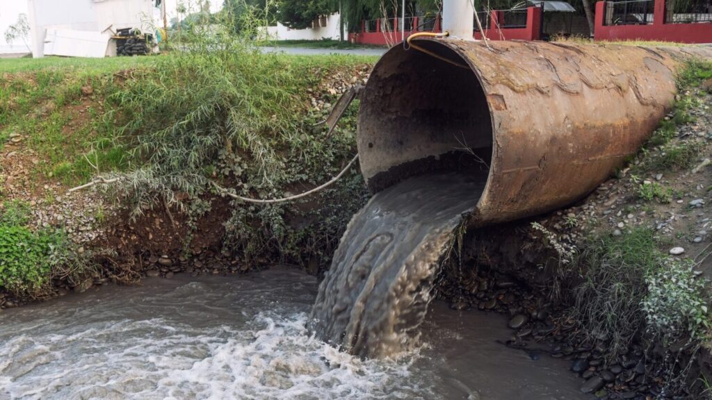
In today’s world, protecting water resources is more critical than ever. At the heart of this mission are environmental engineers, the professionals who design, implement, and refine systems that manage wastewater safely and sustainably. Their work not only protects public health but also preserves the environment for future generations.
Guide to Design a Wastewater Treatment Plant in AutoCAD
Guide to Design a Wastewater Treatment Plant in AutoCAD Introduction Designing a wastewater treatment plant layout requires both engineering insight and careful CAD drafting. This guide provides a step-by-step approach to creating an AutoCAD wastewater treatment plant design that is accurate, organized, and optimized for collaboration. Tailored as a civil engineering AutoCAD guide for city officials, district managers, professional engineers, municipal planners, and AutoCAD designers, the content focuses on conventional activated sludge systems. We’ll cover everything from initial preparation (gathering site plans and survey data) to detailed layout of treatment units, plus AutoCAD plant design tips on layer management, blocks, Xrefs, and leveraging new software features. If you’ve ever wondered how to draw a wastewater treatment plant in AutoCAD efficiently, read on – this guide will walk you through the process in a professional yet approachable tone. Preparation: Gather Site Plans, Surveys, and Design Specs Before diving into drafting, ensure you have all essential references on hand: Before diving into design, gather your site data and set up AutoCAD for success: Import Accurate Survey Data: Start by attaching the site survey as an external reference (Xref) in AutoCAD. Ensure the drawing uses the correct units (typically feet in Colorado) and coordinate system. Bringing in surveyed points, topographic contours, and property boundaries as a base will ground your design in reality. For example, in Yampa’s project, a detailed survey ensured the new facility fit the site and avoided flood-prone areas. Establish Project Specifications: Set up your drawing template with the project’s layers, text styles, and dimension styles per your standards. Include notes from the project specs (e.g. setback requirements, elevations, discharge point) early on. This preparation helps you adhere to municipal plant AutoCAD design criteria from the beginning. Create Reference Geometry: Draw key reference lines such as property limits, easements, and existing utility locations on separate layers. This makes it easy to see constraints when laying out the treatment units. A well-prepared site plan underlay speeds up the entire wastewater plant layout AutoCAD process by providing context for all design elements. Layer Management and External References (Xrefs) Organizing your drawing with layers and Xrefs is crucial for clarity, especially on complex municipal projects: Use Logical Layer Naming: Separate major categories into layers – e.g., civil site work, structural elements, mechanical piping, electrical, and annotations each on their own layer group. Adopting a consistent naming convention (such as the National CAD Standard) can help differentiate systems. For instance, some designers use a “D” prefix for process design layers (D for “Process”), so layers like D-RAWS-PIPE could denote raw sewage piping and D-RAS-PIPE for return activated sludge lines. Clear layer names ensure anyone reviewing the drawing can instantly distinguish a sludge line from a clean water line. Layer Properties for Clarity: Assign distinct colors or linetypes to different systems – for example, use dashed lines for buried pipes or a specific color for electrical conduits. Keep consistent layer settings (line weights, etc.) so that when the plan is printed, the treatment units and pipes are clearly visible. Layer filters or layer states in AutoCAD can be used to toggle views (e.g., show only civil vs. only mechanical) for easier editing. External References for Collaboration: Break the project into multiple drawings and Xref them together. A common approach is to have a base site plan Xref (with survey and civil features) and separate Xrefs for mechanical process piping or structural details. This way, multiple team members can work in parallel – for example, one drafter updates the site grading while another refines the piping layout. Attach Xrefs as Overlay to prevent nested references from cluttering other drawings. By managing Xrefs and layers carefully, your AutoCAD drawing remains organized even as the design evolves. Don’t forget to periodically purge unused layers and Xrefs to keep the file lightweight and efficient. Layout Tips for Major Treatment Units (Headworks, Aeration, Clarifiers, Sludge Systems) Drafting the major components of a conventional activated sludge plant requires both engineering insight and CAD technique: Headworks Placement: Begin at the plant’s starting point – the headworks (influent screening and grit removal). Position the headworks structure at the incoming sewer location to minimize inlet pipe runs. Allow space for maintenance access (e.g., a driveway for service trucks to remove screenings). In AutoCAD, use concrete pad outlines or equipment blocks to represent the screening unit and any grit chamber. Ensure this area is on a layer for structures and label it clearly (e.g., “Influent Screen”). Aeration Basins: Next, lay out the aeration basin(s) downstream of the headworks. For a conventional activated sludge system, these basins are typically rectangular tanks. Draw the basin walls to scale using actual design dimensions (length, width, and water depth) provided by the process engineer. It’s wise to maintain symmetry and straight flow paths – place aeration basins such that flow can go by gravity to the clarifiers. In the Yampa WWTP design, the aeration basin was oriented to feed two secondary clarifiers by gravity, which simplified piping. Use hatches or fill to distinguish water areas, and consider adding text or a block indicating diffusers or aerators within the basin. Secondary Clarifiers: Position the clarifier(s) immediately after the aeration basin. Often these are circular in plan. Use a circle or polygon of the correct diameter to represent the clarifier tank. If your clarifier is 40 feet in diameter, draw it exactly to scale – precise geometry ensures all piping fits later. Leave room around clarifiers for walkways and sludge pump stations. You might Xref in manufacturer drawings for the clarifier mechanism to get details like center pier or rake arms if needed, or simply represent them with centerlines and a note. Label each clarifier (e.g., “Secondary Clarifier No.1”) and denote the water flow inlet and effluent weir locations on your plan for clarity. Sludge Handling Systems: Include space for sludge processing units. This could be an aerobic digester, sludge holding tank, or dewatering equipment depending on your design. For drafting, place sludge facilities near the clarifiers to shorten sludge piping
How BioLargo’s Aqueous Electrostatic Concentration Solves PFAS Contamination
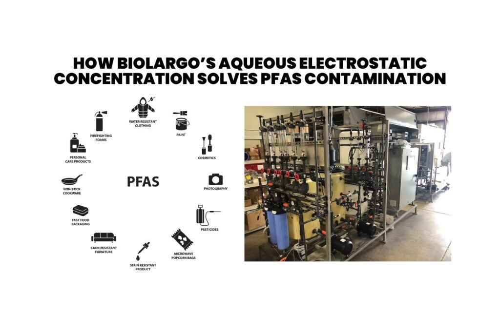
In this episode of Engineers for Communities, we spoke with Tanya Chandler and Sally Gutierrez from BioLargo about tackling one of today’s most critical environmental challenges: PFAS contamination. Known as “forever chemicals,” PFAS are widespread in U.S. water systems, posing serious risks to health and the environment. Tanya and Sally shared insights into the issue and groundbreaking solutions that can make a difference.
Optimizing Collection Systems: Advanced Solutions for I&I Challenges in Rural Communities
In today’s episode of Engineers for Communities, we delve into a pressing issue facing many rural municipalities: inflow and infiltration (I&I). I’m joined by R.H. Borden, who introduces remarkably simple, yet effective technology designed to tackle I&I challenges efficiently. This device, easily installed in manholes, offers a promising solution to accurately locate and address I&I issues within a matter of feet.
Aging Infrastructure and Regulatory Changes in Small Water Systems
These new rules demand significant updates in their operational practices to meet the October 2024 deadline. For smaller water systems, this presents a tough challenge as many lack the necessary resources and data to seamlessly adapt to these requirements.
Importance of Managing Water Loss in Rural Areas
Water loss in small towns wastes resources and puts a strain on their economies and environments. This article looks at why understanding and managing water loss is essential and how it leads to better management and saves money.
Water and Wastewater Technical Assistance for Rural Communities with RCAP
The Rural Community Assistance Partnership (RCAP) is a national network of nonprofit partners with over 350 technical assistance providers across the country. RCAP is dedicated to enhancing the quality of life in rural and tribal communities through various environment-focused programs.
PFAS Polluters to Pay $14.75 Billion Settlement Direct to Public Water Systems

Today, we’re diving deep into the subject with insights from Sam Wade, former CEO of the National Rural Water Association, and current Water Consultant to Napoli Shkolnik Law to understand the legal landscape and financial opportunities available to utilities grappling with PFAS contamination.
Mechanical Wastewater Treatment: Simple Solutions for Solids Management
Welcome to another episode of “Engineers for Communities,”, where we delve into innovative solutions that impact rural communities, developers, and engineers.
Biden-Harris: Taking a Stand Against PFAS Pollution
The Biden-Harris administration is making gigantic steps in the fight against PFAS pollution which degrades our environment and health.
Advancements in Wastewater Treatment: Screen Technologies and Grit Removal Innovations

n this episode, we engage with Simon Randle, who brings light to the latest advancements in wastewater treatment technologies. We delve into diverse solutions that are reshaping how wastewater is managed, from intricate screen technologies at the very beginning of the treatment process to advanced grit removal systems.
Cutting-Edge Water Treatment Solutions: Mixers, Polymers, and Chloramines

Welcome to our recent episode of ‘Engineers for Communities,‘ where we dive into innovative water treatment technologies. Today, we’re excited to share our conversation with David Stanton from Cleanwater1. David introduced us to some fantastic tools that are changing the game for water utilities, big and small.
All You Need to Know About America’s Aging Water Infrastructure Crisis

America’s water infrastructure is facing a multitude of challenges that demand our attention and innovative solutions. From aging pipes to water contamination, the issues are diverse, and the consequences can be far-reaching.
Denver Water: Accelerating Lead Service Line Replacement via BIL Funding

Clean water is a must for everyone. Despite delivering lead-free drinking water through the water main, lead can still enter the drinking water of customers with lead service line pipes and fixtures located on their property. Lead in drinking water is a significant health concern, especially for babies, youth, and pregnant women.
A Deep Dive into North Texas Municipal Water District’s (NTMWD) Environmental Commitment

The North Texas Municipal Water District (NTMWD) plays a pivotal role in the region’s water landscape, providing wholesale wastewater services to 24 communities and serving a substantial 1.4 million residents.
A Comprehensive Vision for Water Infrastructure Investment

As Texas stands on the brink of its 2024-2025 biennium with an impressive $32.7 billion surplus, a golden opportunity emerges to shape the state’s future through strategic investments in water, wastewater, and flood/stormwater projects.
Maximizing Efficiency in Wastewater Collection and Treatment

Orenco’s cutting-edge wastewater treatment systems are changing the game. In a candid conversation between Bill Snyder and Big Mike, we explore these innovative systems, diving into their functionality, applications, and the advantages they offer in terms of efficiency and cost savings.
Maximizing Efficiency and Minimizing Costs of Reverse Osmosis Systems

We delve into the Reverse Osmosis Systems, exploring their applications, efficiency, and how you can significantly reduce operational costs.
What is an Extraterritorial Jurisdiction (ETJ) in Texas?

In the context of Texas, “ETJ” stands for “Extraterritorial Jurisdiction.” The ETJ refers to the area outside the official boundaries of a city or municipality where the city has limited regulatory authority and planning control. It is essentially a buffer zone that allows a city to extend its influence beyond its corporate limits for future growth and development.
3 Important Lessons on Upgrading Community Development: The Role of Lift Stations

Welcome to this blog post where we’ll dive into three key lessons from the enlightening Engineers for Communities Episode 12 titled “Lift Stations 101: Why It Matters to Your Community Development.” In this exciting episode, Mike explores the significance of lift stations, their impact on your community’s infrastructure, and the critical aspects of their operation and maintenance. Let’s get started and uncover the valuable insights shared in this episode!
Leveraging the State Water Implementation Fund for Texas (SWIFT) for Rural Water and Sewer Communities: An Exploration
Inflow and Infiltration (I&I) is a critical factor that impacts wastewater collection systems and wastewater treatment plants. Simply put, I&I refers to stormwater and groundwater that unintentionally enters the sewer system. This usually happens via illegal connections, cross connections, foundation drains, roof drains, broken lines, unsealed manholes, or root infiltration.
Key Take Aways From EP11: “How Inflow and Infiltration Impacts Your Collection System and Wastewater Treatment Plant”

Inflow and Infiltration (I&I) is a critical factor that impacts wastewater collection systems and wastewater treatment plants. Simply put, I&I refers to stormwater and groundwater that unintentionally enters the sewer system. This usually happens via illegal connections, cross connections, foundation drains, roof drains, broken lines, unsealed manholes, or root infiltration.
Unlocking The Power of the Rural Water Assistance Fund for Your Community
As dedicated contributors to rural water and sewer communities, we all wear multiple hats. One important part of our role is understanding and utilizing available resources to maximize the potential of our local water and sewer systems. Today, we are focusing on a game-changing resource for small rural utilities, the Rural Water Assistance Fund (RWAF) Program.
Transforming Rural Water and Sewer Communities: Unlock the Potential of the Texas Water Development Fund (DFund) Loan Program
Living in a rural water and sewer community means playing various roles to ensure the wellbeing of your neighbors. This responsibility also involves learning about different ways to enhance the quality of life for everyone around you. One such avenue is through funding programs, such as the Texas Water Development Fund (DFund) Loan Program, that can help improve water and wastewater infrastructure. Here are the key things you need to know about the DFund and how it can be beneficial for your community.
Revitalize Your Community with the USDA Water & Waste Disposal Loan & Grant Program in Texas
Navigating the waters of rural water and sewer systems can be challenging. But did you know that there is a funding mechanism available to help improve your community’s water infrastructure? The Texas Water Development Board’s Drinking Water State Revolving Fund (DWSRF) Loan Program could be the key to unlocking significant improvements in your water and sewer services. Here’s what you need to know.
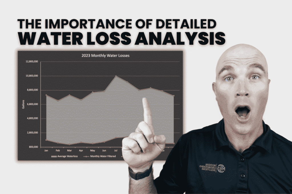
Uncovering the Potential of Detailed Water Loss Analysis in Rural Communities
In a recent episode of Engineering for Communities Live, The Importance of Detailed Water Loss Analysis | EP 9, we explored the significance of conducting detailed water loss analysis in rural water and sewer communities. We initiated the discussion by sharing insights from our interviews with water and sewer providers in Colorado and Texas. Surprisingly, half of the 14 water providers interviewed were grappling with unidentified water losses, highlighting the need for a more comprehensive approach.
Unlocking the Potential of the Drinking Water State Revolving Fund (DWSRF) for Your Rural Water Community
Navigating the waters of rural water and sewer systems can be challenging. But did you know that there is a funding mechanism available to help improve your community’s water infrastructure? The Texas Water Development Board’s Drinking Water State Revolving Fund (DWSRF) Loan Program could be the key to unlocking significant improvements in your water and sewer services. Here’s what you need to know.
Unlocking Funding Opportunities: The Texas Water Development Board’s Clean Water State Revolving Fund (CWSRF) Loan Program
In rural water and sewer communities, we are the stewards of our natural resources. We understand the importance of maintaining clean water for our families, farms, and future generations.
Making the Most of the Economically Distressed Areas Program (EDAP) for Your Rural Water and Sewer System
In rural water and sewer communities, we are the stewards of our natural resources. We understand the importance of maintaining clean water for our families, farms, and future generations.
Knowing When Your Wastewater Treatment Plant (WWTP) Needs to be Upgraded: A Guide for Rural Communities
In rural water and sewer communities, we are the stewards of our natural resources. We understand the importance of maintaining clean water for our families, farms, and future generations.
Why a Detailed Water Loss Analysis Matters for Rural Communities
Water is a precious resource, especially in rural areas. Keeping track of how much water is being used and making sure none is wasted is very important. In this article, we will talk about why a detailed water loss analysis matters and how it can help rural water and sewer communities save money and protect their water resources.
Innovative Water Treatment Technologies for Rural Communities: Affordable and Sustainable Solutions
As a member of a rural water and sewer community, you understand the importance of providing clean and safe water to your neighbors. Your commitment to your community is unmatched, and you continuously look for ways to improve the quality of life for those around you.
Why Electrocoagulation Matters for Rural Water and Sewer Providers
Why Electrocoagulation Matters for Rural Water and Sewer Providers In recent years, electrocoagulation has emerged as a game-changing wastewater treatment technology, especially for rural water and sewer providers. Offering several advantages over traditional treatment processes, electrocoagulation is gaining popularity and backed by extensive research. In this blog, we’ll explore the reasons behind the increasing adoption of electrocoagulation and discuss specific examples that highlight its importance for rural water and sewer providers. The Advantages of Electrocoagulation for Rural Providers: Electrocoagulation offers numerous benefits that make it particularly appealing to rural water and sewer providers: Improved efficiency: Electrocoagulation effectively removes a wide range of pollutants, including heavy metals, suspended solids, and organic compounds, resulting in cleaner effluent. This is crucial for rural providers who often face challenges in meeting stringent water quality standards (1). Cost-effectiveness: This technology requires fewer chemicals and produces less sludge than traditional methods, reducing operational costs and simplifying sludge disposal. This is particularly beneficial for rural providers who often operate on limited budgets (2). Scalability: The modular design of electrocoagulation systems allows for easy expansion and adaptation to meet changing treatment requirements. This adaptability is critical for rural providers who must accommodate fluctuating populations and wastewater loads (3). Environmental sustainability: Electrocoagulation generates fewer greenhouse gas emissions and has a smaller carbon footprint than conventional treatment processes, promoting sustainable practices in rural communities (4). Real-World Examples for Rural Providers: Electrocoagulation has shown promising results in various rural settings. A study conducted in rural India demonstrated the technology’s effectiveness, as electrocoagulation removed over 90% of pollutants from domestic wastewater (1). This case highlights the technology’s ability to address the unique challenges faced by rural providers in developing regions. Another example comes from the successful implementation of electrocoagulation systems in small- and medium-sized wastewater treatment plants across the United States. Companies like Genesis Water Technologies offer a range of electrocoagulation solutions tailored to meet the needs of rural water and sewer providers, helping them achieve improved wastewater treatment outcomes and comply with strict regulations. Electrocoagulation is revolutionizing wastewater treatment for rural water and sewer providers by offering improved efficiency, cost-effectiveness, scalability, and environmental sustainability. As more rural providers adopt this innovative technology, we can expect to see significant improvements in wastewater management and overall water quality in rural communities. Stay informed about the latest developments in electrocoagulation and other wastewater treatment technologies by following our blog at Modern Engineering Solutions. References: (1) Emamjomeh, M. M., & Sivakumar, M. (2009). Review of pollutants removed by electrocoagulation and electrocoagulation/flotation processes. Journal of Environmental Management, 90(5), 1663-1679. (2) Vasudevan, S., & Lakshmi, J. (2011). Electrocoagulation of textile industry effluent using iron and aluminium electrodes. Journal of Chemical & Engineering Research, 3(2), 63-69. (3) Zodi, S., Potier, O., Lapicque, F., & Leclerc, J. P. (2011). Treatment of the textile wastewaters by electrocoagulation: Effect of operating parameters on the sludge settling characteristics. Separation and Purification Technology, 81(1), (4) Kobya, M., Can, O. T., & Bayramoglu, M. (2003).
Three Things You Need to Know for a Better Community Water and Sewer System

Contributing to a rural water and sewer community, you wear many hats and often have to learn a wide range of skills to make your job a success.
First Steps to Getting Your Project Approved with Denver Water

Effective Jan. 1, 2023, Denver Water is implementing mandatory computer-based training for all design engineers that submit plans for review.
Wastewater Engineering and Permitting
Wastewater Engineering and Permitting If you are a developer/property owner in a construction project, you must arrange for adequate storm and sanitary sewer services to the development site. The developer (property owner) will need to contact the appropriate wastewater engineer. The City and County of Denver’s Wastewater Engineering Department has final say over any new major development and redevelopment in the county. This includes development requiring a permit that results in the discharge of stormwater or wastewater, such as those resulting from the following: Sites and development of one-half acre or more Sanitary sewer lines Storm lines Drainage channels Water quality facilities The Wastewater Engineering and Permitting Division provides services to meet Denver’s current and future needs for safe and effective wastewater collection, transport and treatment. Applications for construction permits are processed as either minor construction or major construction through the combined efforts of Development Services and Denver Department of Transportation Construction Activities Stormwater Discharge Permit (CASDP) A Construction Activities Stormwater Discharge Permit (CASDP) is required for any project that meets the criteria listed below, or at the discretion of the DS Engineer. Stormwater Management Plans are required for development activities that include the disturbance of one acre or more; site development or redevelopment that is part of a larger plan; site development or redevelopment which has significant potential for erosion; or construction activities on soils contaminated by hazardous pollutants. The Construction Plan and Drainage Report or the Sanitary Sewer Study are required at the discretion of the Development Services engineer. This study must be done by a licensed professional engineer like Michael Groselle, P.E. from Modern Engineering Solutions, who will prepare a site plan to show the extent of work proposed; existing topographical contours, grades, and drainageways; proposed grades and profiles for roads, channels, and foundations; locations of existing drains and manholes; plans for structures (if any); proposed treatment facilities; proposed landscaping features such as curbs, sidewalks, fences (if any), etc… This guide helps the design professional consider and incorporate aesthetic elements at the earliest stages of designing a stormwater detention pond when an above-ground facility is chosen as a method to control stormwater runoff. It provides a process review, design considerations and tools to assist professionals in meeting their clients’ aesthetic needs while achieving technical requirements. Aesthetically enhanced detention and water quality ponds(PDF, 8MB) Step 1: Requirements for Submittal Storm Drainage Submittal and Sanitary Sewer Requirements Application to Construct (TEP Application)(PDF, 180KB) Attachment #1 – Engineers Certification Block(PDF, 13KB) Attachment #2 – Irrevocable Letter of Credit Sample(PDF, 118KB) Attachment #3 – Certificate of Inspection Letter Sample(PDF, 180KB) Attachment #4 – Title Block Sample(PDF, 362KB) Development Services Sanitary and Storm General Submittal Guidelines(PDF, 251KB) Easement Relinquishments Entrance Requirements(PDF, 586KB) Fees Sample Letter of Certification(PDF, 74KB) Sewer Main Build Over Requirements(PDF, 86KB) Sewer Main Line Abandonment Requirements(PDF, 88KB) Sample Permanent Non-Exclusive Easement (PNEE)(PDF, NOTE: Developments and Projects over 1 acre (both residential AND commercial) will also require a Construction Activities Stormwater Discharge Permit (CASDP) Step 2: Sewer Use and Drainage Permits (SUDP – Wastewater) See the Sewer Use and Drainage Permit page for complete information on Wastewater SUDP permits. Step 3: Standards and Details The following technical documents can be downloaded from the Department of Transportation & Infrastructure, Right of Way Services, Technical Documents page. Manuals and Regulations or Department of Transportation & Infrastructure Document Center. Sanitary design and technical criteria manual Sanitary sewer master plan Storm drainage design and technical criteria manual Storm drainage master plan Wastewater detail and technical specifications Wastewater standard detail drawings Step 4: Standard Fees For information on DOTI standard fees, see Department of Transportation and Infrastructure (DOTI) /SUDP under Building and Land Development Fees.
Aerobic System Inspection & Maintenance
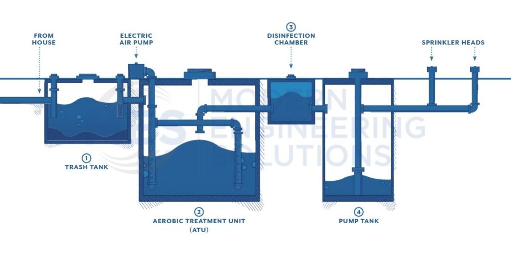
Aerobic System Inspection & Maintenance Aerobic treatment is a type of surface application that uses oxygen and or air to break down organic pollutants. The process of aerobic treatment is also known as activated sludge. The wastewater is mixed with microorganisms that feed on the organic pollutants. The mixture is then agitated to keep the microorganisms alive and breaking down the pollutants. Oxygen or air is then added to the mixture to help the process along. The wastewater then flows over a series of sloped surfaces which helps to separate the liquids from the solids. The liquids are then collected and discharged while the solids are dried and disposed of. The process is considered an anaerobic process because it does not use oxygen. The wastewater is mixed with microorganisms that feed on the organic pollutants. The process of aerobic treatment is one that uses a type of microorganism known as “bacteria”. The bacteria are allowed to produce enzymes that are toxic to the pollutants. The resulting toxins and organic wastes are then removed by the wastewater treatment plant. The activated sludge process is a technique for treating sewage. The process of aerobic treatment uses bacteria to help break down the pollutants in the wastewater. The toxic chemicals are then removed from the wastewater by a series of processes known as “biochemical oxidation”. The activated sludge process is a technique of sewage treatment that uses a biological agent to kill the microorganisms and promote the growth of organisms that can remove pollutants from the wastewater. Developer SERVICES Trinity Retail Plaza PROJECT Water and Wastewater Solutions SERVICES Arabian Acres Metropolitan District Treatment Improvement PROJECT Engineering Firms SERVICES Extraterritorial Jurisdiction (ETJ) BLOG
Types of Sewer Systems
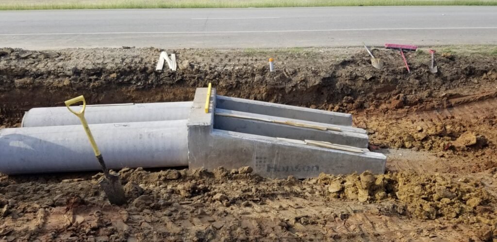
Types of Sewer Systems The Colorado landscape is dotted with Colorado land drainage systems, used to move water away from dry regions and into rivers and reservoirs. The state has more than 1,000 miles of canals and ditches, most of which were built in the 1800s to serve as a primary means of transportation and irrigation. Over time, many of these waterways have been replaced by paved roads or other forms of infrastructure, but they continue to play an important role in Colorado’s economy and culture. City planners must take into account many factors when designing a city, including the type of drainage system to be used. The most common type of drainage system is the underground storm sewer. This system consists of a network of pipes that collect rainwater and runoff from streets and other paved areas and carries it away from the city. There are several other types of drainage systems, each with its own advantages and disadvantages. Storm Sewer Systems Storm sewer systems are usually underground and carry away the water from streets and other paved areas. Sanitary sewers also carry sewage away from homes and businesses, as well as industrial waste. Combined sewer systems are underground networks that carry both storm water and sewage. Combined sewer systems are rarely used anymore and have been a big problem in major cities like New York City. Storm sewers are usually found in urban areas. They receive runoff from streets and other paved areas, as well as industrial waste, and carry that water away from the city. Sanitary Sewer Systems Private sewers are underground pipes that carry wastewater away from homes and businesses. Most private sewer service is provided by a private company, usually the same type of company that provides municipal services. In the United States, sewer systems are regulated by the U.S. Environmental Protection Agency (EPA), which uses a set of standards called the National Pollutant Discharge Elimination System (NPDES). The majority of sewer systems consist of a series of open-ended, underground pipes that carry wastewater from homes and businesses to a treatment plant, where it is treated. How Does City Drainage Systems Work? City drainage systems are made up of many different components that work together to move rain and snow out of the city and into rivers or oceans. The main components of a city drainage system are the storm sewer, street drainage, water main, and culverts. Typical storm sewers are open-ended, underground pipes that carry wastewater from rooftops to a treatment plant. They typically consist of pipe diameters from 12 inches to over 10 feet. The street drainage system is usually the primary means of transporting stormwater runoff from the roads to sewers. It consists of a network of channeled pipes and concrete boxes, sometimes called “swales” or “road swales”. In the United States, stormwater management is typically limited to the “urban” watershed level. In other words, local governments are responsible for managing runoff from their own streets and buildings. Tagged sanitary, sewer system, storm
Septic Tank & Absorptive Drainfield

Septic Tank & Absorptive Drainfield Septic tanks and absorptive drainfields are two common wastewater treatment technology options for on site treatment. Septic tanks work by breaking down the waste matter in the sewage into small particles that can be removed by the soil. Septic tanks are a cheap option, but they require frequent maintenance to remove the waste matter and other matter that is not broken down. Gravel or slag can be added to the tank to make it a more effective means of treatment. Septic tanks can be used to treat domestic sewage, but they are typically not suitable for the treatment of industrial waste. Absorptive drainfields use a layer of sand or other absorbent material to soak up water and waste, then displace it through a trench to an underground drainage system. A septic tank absorption field system is a type of subsurface irrigation that uses aerated soil in the tank to help eliminate excess salts from the treated water. The system consists of a buried pipe that connects a septic tank to an underground, pressurized distribution system. Aeration of the soil in the tank allows for the water to be pumped through the pipe and then out into a subsurface drip or sprinkler system. There are many different types of treatment and disposal options when looking to treat wastewater on-site. If you need help understanding local and state regulations or have questions about when system suites your use best reach out to us today!
