
Blog
Trinity River Floodway Extension Rules and Treatment Plant Siting: How Detention Requirements Constrain Riverside Development
Trinity River riverside parcels lose usable acreage to floodway limits and detention before wastewater siting begins. Learn how to map all three constraints together.
Quick Answer
Treatment plant siting for Trinity River area riverside development is directly constrained by floodway limits, which typically prohibit new structures and fill within the mapped floodway, by detention pond sizing requirements that often claim substantial acreage in the same low lying areas a treatment plant, lift station, or land application area would otherwise use, and by setback and access requirements drainage authorities impose on infrastructure near the river and its tributaries. A parcel’s gross acreage figure is not a reliable indicator of how much usable area actually remains once floodway, floodplain, and detention requirements are mapped against it, and a wastewater strategy developed without that mapping in hand risks discovering, late in design or during permit review, that the intended treatment plant location isn’t actually available, forcing a redesign, a relocation, or in some cases a fundamental reconsideration of the site’s wastewater strategy. Developers evaluating Trinity River area riverside sites should commission combined floodplain and wastewater feasibility analysis before committing to a specific treatment plant location, disposal strategy, or site plan.
Why Trinity River Riverside Sites Present a Compounded Constraint Problem
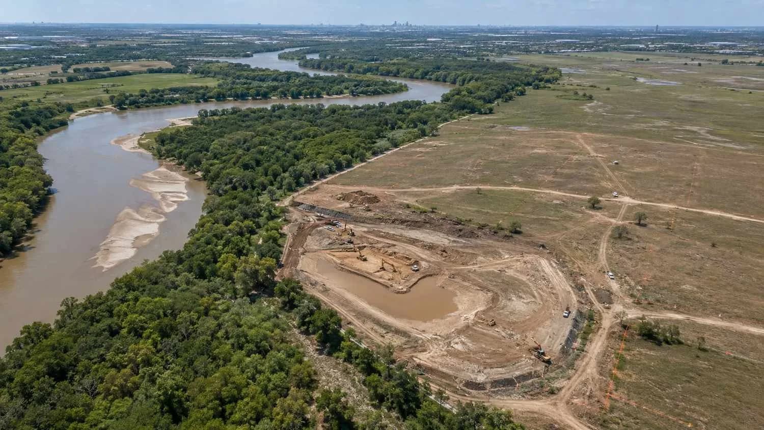
Most wastewater treatment plant siting decisions involve evaluating topography, access, setback from property lines and water features, and disposal method feasibility as a relatively contained set of considerations. Trinity River area riverside development adds floodway and floodplain constraints on top of that already substantial list, and the specific geography of Trinity River adjacent land, often low lying by definition since it’s near a major river system, means these floodway and floodplain constraints frequently overlap with exactly the areas a wastewater strategy would otherwise prefer to use.
A treatment plant, lift station, or land application area benefits from being sited at a lower elevation relative to the development it serves, since lower elevation simplifies gravity flow into the facility and can be favorable for TLAP disposal areas depending on the specific application method. This same lower elevation preference frequently puts these facilities in direct competition with the floodway, floodplain, and required detention areas for the same limited low lying acreage on a riverside parcel, a competition that doesn’t exist to nearly the same degree on a site without significant river or floodplain influence.
Floodway Limits as a Hard Constraint on Facility Location
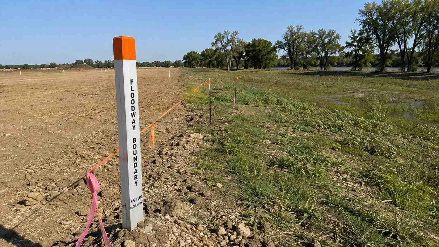
The floodway, the portion of the floodplain that must remain clear to convey floodwater without significantly increasing flood elevations elsewhere, typically carries the most restrictive development limitations of any floodplain related designation, generally prohibiting new structures, fill, and in many cases any development at all within its mapped boundary. A wastewater treatment plant, being a structure, cannot be sited within the floodway regardless of how favorable the location might otherwise appear from an elevation or access standpoint, and this floodway boundary should be confirmed through current, site specific floodway mapping early in site evaluation, since floodway boundaries can be more restrictive, and in some cases more precisely different from general floodplain boundaries, than a developer might assume from a general familiarity with the site’s flood zone designation.
Confirming the floodway boundary specifically, rather than relying on the broader floodplain designation alone, matters because a location just outside the floodway but still within the broader floodplain may be developable with appropriate elevation and floodproofing measures, while a location within the floodway itself generally isn’t developable at all regardless of what measures a developer might propose. This distinction should be established definitively before any specific treatment plant siting decision is finalized, not discovered during permit review after site planning has already proceeded based on an assumption about which areas are actually available.
Detention Pond Sizing Competing for the Same Acreage
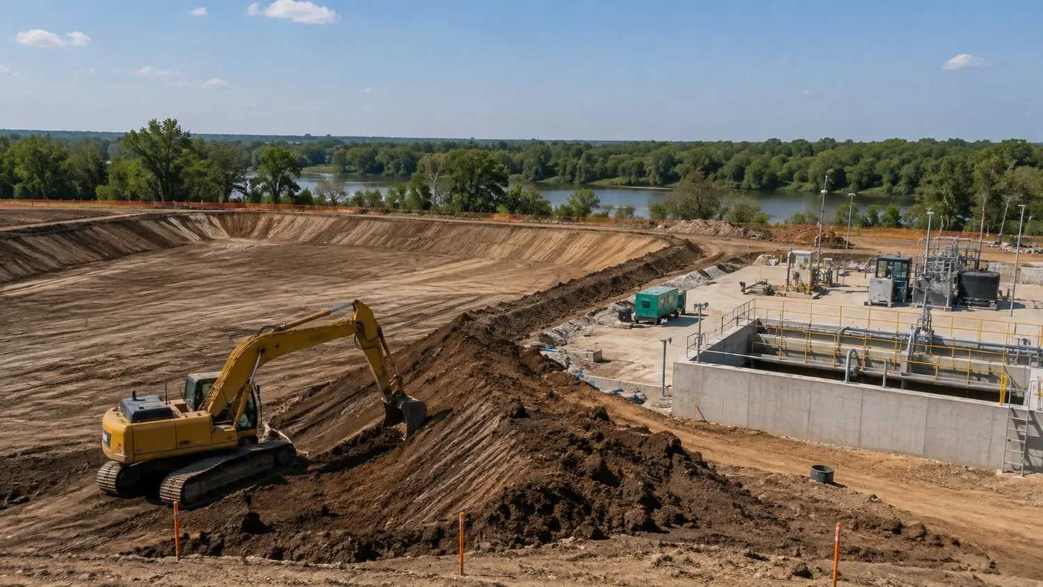
Stormwater detention requirements for Trinity River area development, whether imposed by the City of Dallas, another municipality along the river corridor, or a relevant drainage authority, require detention pond capacity calculated from the site’s impervious cover and applicable design storm criteria, and this detention footprint frequently needs to be sited in the same low lying portions of a riverside parcel that a treatment plant, lift station, or land application area would also prefer. When a site plan reserves detention capacity first and treats treatment plant siting as a secondary consideration to be worked out afterward, the detention pond’s footprint can consume enough of the site’s genuinely low lying, developable outside the floodway acreage that little usable area remains for the wastewater facility, forcing it into a less favorable location that increases pumping requirements, complicates access, or in the worst case doesn’t leave adequate area at all.
This is the same underlying coordination failure relevant to McKinney subdivision detention and utility conflicts, but the stakes are higher on a Trinity River adjacent site because the floodway constraint removes options that would otherwise be available on a site without floodway influence, leaving a genuinely smaller pool of viable locations for both the detention pond and the treatment facility to compete over. Evaluating detention pond sizing and treatment plant siting together, against the same floodway and floodplain mapping, from the earliest site planning stage is considerably more important on a riverside site than on a site without this compounded constraint.
Treatment Plant Elevation and Access During Storm Events
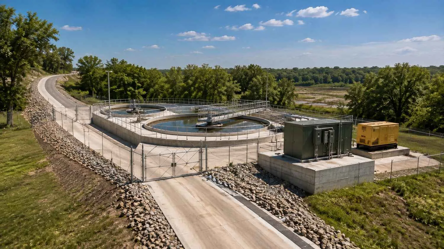
A treatment plant sited outside the floodway but still within the broader floodplain needs its critical elevations, finished floor, electrical equipment, and control systems, set with the same flood resilient design principles relevant to Houston area coastal facilities, adapted here to the Trinity River’s specific flood elevation and frequency characteristics rather than hurricane storm surge. Electrical equipment protection deserves the same priority discussed for coastal facilities, since submerged electrical components remain one of the most common and most preventable failure points during flood events regardless of whether the flooding originates from a hurricane, a major regional rainfall event, or Trinity River flooding specifically.
Access to the treatment plant during and immediately after a flood event is a related consideration that’s easy to overlook during initial siting, since a treatment plant sited on ground that stays above floodwater but that can only be reached by an access road that itself floods during the same event effectively becomes inaccessible exactly when operators most need to reach it, whether for emergency response or routine operational needs that don’t pause simply because a flood event is occurring. Access road elevation and routing should be evaluated against the same flood elevation data used to establish the treatment plant’s own site elevation, not assumed adequate simply because the treatment plant structure itself is sited above flood elevation.
Lift Station Location, Force Main Routing, and Outfall Placement
Where a riverside development’s wastewater strategy includes a lift station, whether to serve a treatment plant sited at a location requiring pumped flow or to convey flow toward an offsite connection point, the lift station’s own siting faces the same floodway and floodplain constraints as the treatment plant itself, and force main routing between the lift station and its destination needs to navigate the same floodway boundary restrictions, potentially requiring a routing that avoids the floodway even where a more direct route would cross through it.
For a wastewater strategy involving TPDES surface discharge, outfall placement into the Trinity River or a tributary requires its own specific coordination with drainage authority setback requirements and erosion protection standards, since a discharge outfall structure sited too close to the river’s active channel, or without adequate erosion protection at the outfall location, can create both a structural failure risk for the outfall itself and, depending on the specific circumstances, an erosion or sedimentation concern the drainage authority will scrutinize during permit review. Erosion protection design at any structure interfacing directly with the river or its floodway, including an outfall structure, should be evaluated specifically for the river’s actual flow velocity and erosive potential at that location, not assumed adequate based on a standard erosion protection detail that may not reflect the site’s specific hydraulic conditions.
Coordination With Drainage Authorities Beyond the Municipality
Trinity River area development frequently involves coordination with drainage authorities beyond just the municipality where the project is located, since floodway and floodplain management along significant river corridors like the Trinity often involves regional or county level drainage authority oversight in addition to municipal review. Identifying every entity with jurisdiction over floodway, floodplain, or drainage requirements affecting a specific riverside parcel, and understanding each entity’s specific setback, detention, and permitting requirements, is a necessary early step, since a wastewater and site plan strategy developed with only the municipality’s requirements in mind can encounter an additional layer of drainage authority requirements later in the process that weren’t accounted for in the original design.
This multi jurisdictional coordination adds complexity and, if not addressed early, schedule risk to a riverside project’s overall permitting timeline, and developers should specifically confirm which drainage authorities have jurisdiction over their site during initial due diligence, rather than assuming municipal floodplain review is the only regulatory layer that applies.
Why This Requires Combined Analysis, Not Sequential Planning
The consistent lesson across floodway limits, detention sizing, treatment plant elevation, and access planning is that none of these considerations can be evaluated in isolation on a Trinity River-adjacent site without risking a conflict that eliminates a location or forces a redesign later. A site plan that reserves floodway area first, then detention area second, then attempts to fit a treatment plant, lift station, and any associated infrastructure into whatever area remains, frequently discovers that insufficient viable area remains once all three claims on the site’s low-lying acreage are mapped simultaneously.
The more reliable approach evaluates floodway boundaries, detention requirements, and wastewater infrastructure siting together from the earliest planning stage, using the same base topographic and floodplain mapping data across all three analyses, so that conflicts and constraints are identified while the site plan still has flexibility to accommodate them, rather than after a specific treatment plant location, detention pond footprint, or lift station site has already been committed to in a preliminary site plan that later review reveals doesn’t actually work.
Frequently Asked Questions
How do we know whether our specific Trinity River area parcel has enough usable acreage outside the floodway to support a private treatment plant along with required detention?
This requires overlaying current, site specific floodway and floodplain mapping against the parcel’s actual topography and your project’s specific detention volume requirement, calculated from your proposed development’s impervious cover, before any conclusion about remaining usable acreage can be reached reliably. General familiarity with the parcel’s flood zone designation isn’t a substitute for this specific mapping and calculation exercise, since the actual usable acreage remaining after floodway and detention requirements are accounted for varies considerably from site to site even among parcels with generally similar Trinity River proximity.
If our preferred treatment plant location turns out to be within the floodway, are there any alternatives besides relocating the facility entirely?
A facility location within the mapped floodway generally cannot be developed regardless of proposed mitigation measures, since floodway restrictions exist specifically to preserve flood conveyance capacity rather than to protect the structure itself, meaning floodproofing measures that might make a floodplain location acceptable typically don’t make a floodway location acceptable. In this situation, relocating the facility outside the floodway boundary, even if that requires accepting a less topographically favorable location with correspondingly more pumping or infrastructure requirement, is generally the necessary path forward, which is exactly why confirming the floodway boundary specifically, and early, matters as much as it does.
Does Trinity River floodway and detention coordination add significant time to our overall project permitting timeline?
The coordination itself, when performed early during initial site feasibility and planning, adds modest time relative to the schedule risk it prevents, since discovering a floodway or detention conflict during permit review, after a site plan and treatment facility location are already finalized, typically costs considerably more schedule time than the upfront coordination would have required. The specific timeline impact depends on how many drainage authorities and municipalities have jurisdiction over your specific parcel and how complex your site’s floodway and floodplain conditions turn out to be, which is precisely the information early combined analysis is intended to surface while your project still has the flexibility to respond to it efficiently.
Related Resources
- Harris County Flood Control Requirements and Your Wastewater System: How Detention Design Affects Treatment Plant Siting
- Post Hurricane Infrastructure Recovery: How Houston Developers Can Build Flood Resilient Water and Wastewater Systems
- Stormwater and Utility Coordination in McKinney’s High Growth Subdivisions: Avoiding the Common Redesign Trap
- Land Application Permits in Texas: A Faster Path to Wastewater Approval for Developers
Evaluating Treatment Plant Siting for a Trinity River Area Development?
MES works with Dallas area developers and municipal reviewers to map floodway and floodplain constraints against wastewater infrastructure siting, coordinate detention requirements with treatment plant and lift station location, evaluate flood resilient design and access planning, and prepare a permitting strategy before site plan commitments are locked in.
We specialize in:
- Combined floodway, floodplain, and wastewater infrastructure siting analysis for Trinity River area development
- Detention pond and treatment plant coordination to resolve competing acreage claims on riverside parcels
- Flood resilient treatment plant and lift station design, including elevation, electrical protection, and access planning
- Force main routing and outfall placement design accounting for floodway setback and erosion protection requirements
- Multi jurisdictional drainage authority coordination for Trinity River corridor development permitting
- Early stage feasibility analysis to identify floodway and detention conflicts before site plan and design commitments are made
Modern Engineering Solutions, Dallas, Texas. Contact: (214) 833-6748 or mod-eng.com
Keep reading
More to read.
Talk to an engineer
Tell us about your project.
An engineer reads it
Not a salesperson. Someone who can tell you whether the pathway is real.
You get a first answer
Your options, the agencies involved and the questions that decide cost and schedule.
You decide
No commitment to have the first call.
Prefer the phone? (214) 833-6748