
Blog
Stormwater and Utility Coordination in McKinney’s High Growth Subdivisions: Avoiding the Common Redesign Trap
McKinney subdivision redesigns happen when stormwater and utility design are sequential, not concurrent. Learn how to avoid the coordination trap before plat submittal.
Quick Answer
Stormwater and utility systems in a McKinney subdivision need to be planned together from the earliest site layout stage, not sequentially, because detention pond placement, drainage easements, and storm drain crossings compete for the same physical space and often the same low lying topography that water and sewer utility routing also needs. When a subdivision’s lot layout and drainage design are finalized before utility routing is checked against them, the most common outcomes are a detention pond that has to be relocated, a road that has to shift, new easements that have to be acquired, or a utility route that has to be redesigned around a conflict that could have been avoided, and each of these fixes typically costs more, takes longer, and sometimes reduces lot yield compared to catching the same conflict during initial concept planning. Coordinating drainage and utility design concurrently, using the same base survey and topographic information, is the practical way to avoid this trap and keep a fast moving McKinney subdivision on its intended plat and construction timeline.
Why This Conflict Shows Up So Often in Fast Growth Subdivision Design
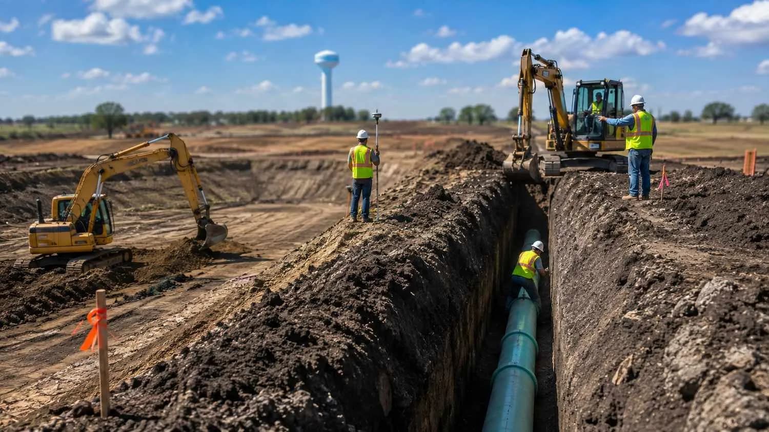
McKinney’s subdivision development pace creates real pressure to move quickly from concept to plat submittal, and that speed is generally a good thing for a developer’s schedule and carrying costs. The risk is that speed sometimes gets applied by working through design disciplines in sequence, civil site layout first, drainage design second, utility design third, each discipline building on what the previous one already fixed in place, rather than working through all three disciplines together against the same site conditions from the outset. Sequential design feels faster in the early stages, since each discipline can move forward without waiting on the others, but it frequently costs more time overall once a downstream discipline discovers a conflict with an upstream decision that’s already been finalized and that the project team is now reluctant to revisit.
Detention pond design and utility routing are particularly prone to this conflict because both disciplines are drawn toward the same site features for similar engineering reasons. A detention pond needs to be located where it can effectively collect and manage the site’s stormwater runoff, which usually means a low lying area with favorable topography for drainage collection. A gravity sewer system or a lift station siting decision is drawn toward the same low lying areas for exactly the same topographic reason, since gravity flow is most efficient when the collection point sits at the lowest practical elevation on the site. When a lot layout is finalized with a detention pond already placed in the site’s most favorable low area, without checking whether that same area was also the utility design’s preferred location, the utility route that gets pushed into a less favorable remaining location can require a lift station that wouldn’t otherwise have been necessary, deeper trenching, or a longer route than the site’s topography would have supported with better upfront coordination.
Detention Pond Placement Versus Utility Corridor Needs
Detention pond sizing for a McKinney subdivision follows the City’s specific drainage design criteria, calculated from the site’s impervious cover and the design storm requirements applicable to the development, and for a moderately dense residential subdivision, this calculation frequently results in a detention footprint that occupies a meaningful share of the site’s total developable area. When this detention footprint is sized and placed without simultaneously checking it against the utility system’s own space needs, gravity sewer routes, water main loops, and any required lift station site, the detention pond can end up occupying ground that the utility design also needed, forcing the utility route into a longer, deeper, or more complicated path once the detention pond’s location is already treated as fixed.
The more efficient approach, evaluating detention pond placement and utility corridor needs against the same site topography simultaneously, sometimes reveals that a detention pond’s footprint and a utility corridor can actually share space efficiently, for instance routing a water main or a portion of the storm drain system along the detention pond’s perimeter or beneath an access easement serving the pond, rather than requiring entirely separate corridors that compete for limited site area. Identifying these opportunities requires the drainage and utility design teams working from the same base plan concurrently, rather than each team optimizing its own system independently before the two designs are compared.
Water and Sewer Alignment Conflicts With Storm Drain Crossings
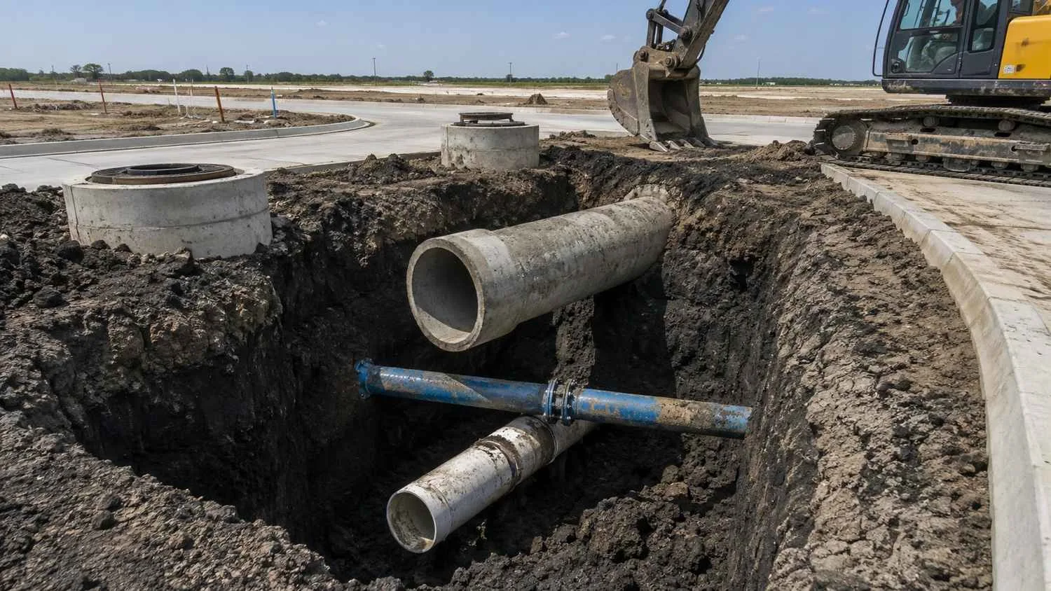
Storm drain pipe networks and water or sewer utility lines frequently need to cross each other at various points throughout a subdivision’s street network, and each crossing point requires specific attention to vertical separation, since utility design standards typically require a minimum vertical clearance between crossing utilities to prevent one from interfering with the other’s installation, maintenance access, or structural support. In a subdivision with a complex storm drain network, particularly one with multiple inlets and trunk lines converging toward a detention pond or outfall point, the number of crossing points where water, sewer, and storm drain lines all need to maintain adequate separation can be substantial, and each crossing represents a location where a depth or alignment conflict could force a redesign if not checked systematically.
Identifying every crossing point during the design’s coordination phase, rather than discovering a specific conflict only when construction plans reach a detailed review stage, or worse, during actual construction when a crew encounters an unexpected conflict in the field, keeps these routine but numerous crossing conflicts from accumulating into a broader schedule problem. This systematic crossing check is a standard part of thorough civil design, but it requires the storm drain and utility layouts to already exist in enough detail to actually check against each other, which is exactly the coordination step that gets skipped when disciplines are worked through sequentially rather than concurrently.
Easements, Access Requirements, and Overlapping Maintenance Responsibilities
Detention ponds, storm drain outfalls, and utility infrastructure each typically require their own dedicated easements, both for the infrastructure itself and for the ongoing maintenance access the responsible entity needs to inspect and maintain that infrastructure over the subdivision’s operating life. When these easement needs are identified separately by each discipline without checking for overlap or conflict, a subdivision’s final easement plan can end up with more total easement area than necessary, consuming developable lot area unnecessarily, or with easements that conflict, for instance a detention pond maintenance access easement that crosses directly over a utility line in a way that complicates both the detention pond’s maintenance access and the utility’s own maintenance and repair access.
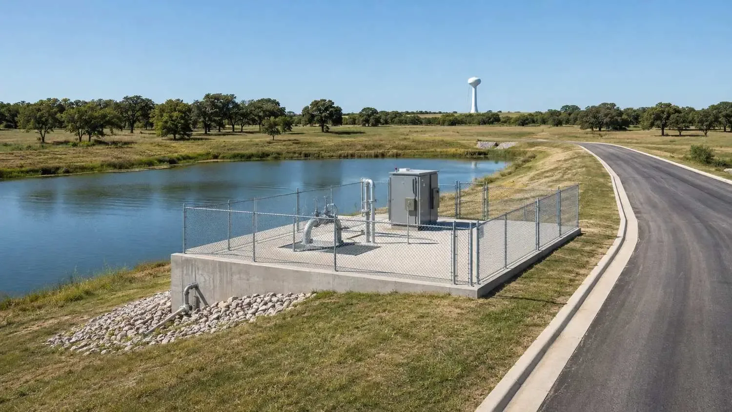
Access requirements deserve specific attention for any lift station site identified within a subdivision, since a lift station requires reliable vehicle access for routine operation and emergency maintenance, and this access requirement should be checked against the detention pond and drainage design to confirm the lift station’s access route doesn’t rely on a road or path that becomes impassable during the storm events the drainage system is specifically designed to manage, a coordination point directly relevant to flood-resilient design generally, applied here at the subdivision utility siting stage rather than at the individual facility design stage.
Utility Depth Conflicts and Grading Constraints
A subdivision’s overall grading plan, which establishes the finished ground elevation across streets, lots, and drainage features, directly affects the depth at which gravity utility lines need to be installed to maintain adequate cover and slope, and a grading plan finalized without checking utility depth implications can create a situation where a sewer line, in particular, ends up needing to be installed at an impractically deep elevation to maintain gravity flow slope across the site’s established grading, adding significant excavation cost and, in soils with the trench stability challenges relevant to North Texas clay conditions, construction risk that a shallower alignment would have avoided.
This grading and utility depth relationship should be checked concurrently during the site’s initial grading design, evaluating whether the proposed grading plan supports a reasonable utility installation depth throughout the site, or whether specific grading adjustments, even relatively modest ones, could meaningfully reduce utility installation depth and cost in specific problem areas without compromising the site’s overall drainage performance or lot grading requirements.
How This Conflict Leads to Lost Lots and Shifted Roads
When a utility or drainage conflict is discovered after a subdivision’s lot layout has already been finalized and, in some cases, already submitted for plat approval, the available fixes are considerably more constrained than they would have been during initial concept planning. Relocating a detention pond to resolve a utility conflict discovered late in design can require shifting adjacent lots or roads to accommodate the pond’s new location, sometimes reducing the total lot count the site can support if the relocated pond’s new footprint displaces lots that can’t be recovered elsewhere on the site. A utility route that has to be redesigned around a conflict discovered late can require new easements through lots that weren’t originally planned to carry an easement burden, reducing those lots’ buildable area or requiring a plat revision to adjust lot lines around the new easement.
Each of these fixes also typically requires revising and resubmitting affected portions of the plat or civil construction plans, which restarts at least a portion of the municipal review clock and can add weeks or months to a project’s approval timeline depending on the extent of the required revision and the city’s current review workload. This combination, lost lots, shifted infrastructure, new easements, and a restarted review timeline, is the practical cost of the redesign trap, and it’s a cost that concurrent drainage and utility coordination during initial site planning is specifically intended to avoid.
Frequently Asked Questions
At what stage of subdivision design should stormwater and utility coordination actually begin?
This coordination should begin during initial concept planning, when the site’s basic lot layout, road network, and detention pond location are first being sketched out, rather than waiting until the concept plan is finalized and detailed utility design begins. Bringing drainage and utility engineering perspectives into the same conversation from the earliest layout sketches, working from the same topographic survey, allows both disciplines to influence the site’s fundamental layout decisions while there’s still flexibility to adjust lot lines, road alignment, and pond placement based on what both systems actually need.
Our civil engineer and our utility designer are different firms. How do we make sure this coordination actually happens rather than falling through the gap between two separate contracts?
This is a genuine risk when drainage and utility design are split between separate firms without an explicit coordination requirement built into both scopes of work, since each firm may reasonably assume the other is handling cross-discipline conflict checking unless the project’s management structure specifically assigns that coordination responsibility to someone. Using a single firm with both civil, stormwater, and wastewater engineering capability under one coordinated team, or if using separate firms, explicitly building joint design review milestones into both contracts and assigning a specific project manager the responsibility for confirming that coordination actually happens at each milestone, are both practical ways to close this gap before it produces a costly late-stage conflict.
Is this coordination problem specific to McKinney, or does it apply to subdivision development generally?
The underlying engineering conflict between detention pond placement, drainage design, and utility routing applies to subdivision development broadly, since the same topographic factors that draw both disciplines toward the same low-lying site areas exist wherever a subdivision is being developed. McKinney’s specific combination of rapid growth, fast-moving review timelines, and rolling terrain that already requires careful pressure zone and utility elevation planning makes the coordination especially important in this market, since the schedule pressure to move quickly through concept and plat approval creates a stronger incentive to skip concurrent coordination than a slower-moving market might, even though the underlying conflict risk is not unique to McKinney specifically.
Related Resources
- McKinney Utility Availability Study: What Developers Need Before Submitting a Plat in Collin County’s Fastest-Growing City
- Water Storage and Pressure Zone Design for McKinney’s Rolling Terrain: Engineering for Collin County Topography
- Harris County Flood Control Requirements and Your Wastewater System: How Detention Design Affects Treatment Plant Siting
- Approved Plans Aren’t Always Optimized Plans: The Difference Can Cost $15 Million
Coordinating Stormwater and Utility Design for a McKinney Subdivision?
MES works with McKinney and Collin County developers and civil design teams to coordinate drainage and utility planning from initial concept layout, identify detention pond and utility corridor conflicts early, resolve easement and crossing conflicts before submittal, and prepare permit ready plats and construction plans that avoid costly late stage redesign.
We specialize in:
- Concurrent stormwater and utility design coordination for McKinney and Collin County subdivision projects
- Detention pond siting and utility corridor conflict resolution during initial concept planning
- Storm drain, water, and sewer crossing analysis and vertical separation verification for subdivision civil design
- Easement planning and maintenance access coordination across drainage and utility infrastructure
- Grading and utility depth coordination to reduce excavation cost and constructability risk
- Permit-ready plat and construction plan preparation for fast-moving McKinney subdivision approvals
Modern Engineering Solutions, McKinney, Texas. Contact: (214) 833-6748 or mod-eng.com
Keep reading
More to read.
Talk to an engineer
Tell us about your project.
An engineer reads it
Not a salesperson. Someone who can tell you whether the pathway is real.
You get a first answer
Your options, the agencies involved and the questions that decide cost and schedule.
You decide
No commitment to have the first call.
Prefer the phone? (214) 833-6748