
Blog
Water Storage and Pressure Zone Design for McKinney’s Rolling Terrain: Engineering for Collin County Topography
McKinney's rolling terrain can cause pressure zone problems developers miss until plan review. Hydraulic modeling finds them before lots are laid out.
Quick Answer
Water distribution system design in McKinney and similar rolling terrain areas of Collin County requires hydraulic modeling that accounts for actual site elevation changes, since even modest topographic relief can create pressure variation across a development significant enough to cause low pressure complaints at high elevations, over pressurization risk at low elevations, and fire flow deficiencies that a flat terrain design assumption would miss entirely. This modeling determines where pressure zone boundaries need to fall, whether a booster pump station is needed to serve higher elevations adequately, whether pressure reducing valves are needed to protect lower elevations from excessive pressure, and how storage tank siting and capacity should be coordinated with the specific pressure zones the site’s terrain creates. Developers who commission this hydraulic analysis during initial site planning, before lot layout and civil design are finalized, can design around the terrain’s real constraints. Developers who skip this step and discover a pressure problem during construction plan review or, worse, after construction is complete, face a redesign that’s considerably more expensive and disruptive than the upfront modeling would have cost.
Why McKinney’s Rolling Terrain Creates a Genuine Engineering Challenge
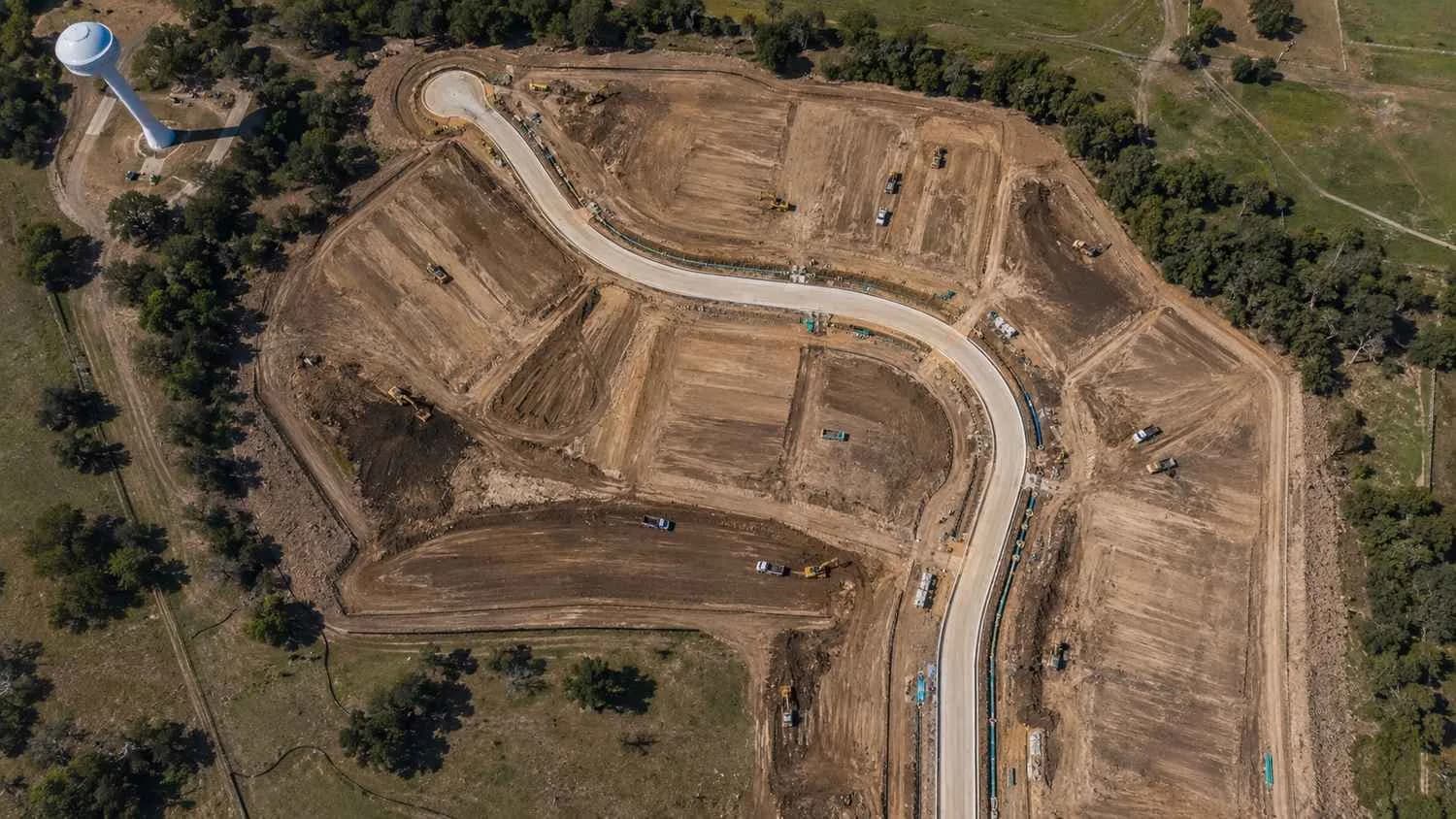
Water pressure in a distribution system is directly related to elevation, following straightforward hydraulic principles: for a given water source and system configuration, pressure at any point in the system decreases as elevation increases and increases as elevation decreases, all else being equal. In a perfectly flat service area, this relationship doesn’t create much design complexity, since every point in the system sits at roughly the same elevation and experiences roughly the same pressure. McKinney’s rolling terrain, with elevation changes that can span fifty to a hundred feet or more within individual development sites and considerably more across the broader service area, means this simple relationship becomes a genuine design variable that has to be actively managed rather than assumed away.
A single large development spanning a meaningful elevation range can have areas that would experience inadequate pressure if served by a system designed around the site’s average or lowest elevation, and other areas that would experience excessive pressure, with associated main break risk and customer complaints about banging pipes or fixture damage, if served by a system designed around the site’s highest elevation without pressure reducing measures for the lower areas. This isn’t a hypothetical concern specific to unusually hilly sites. It’s a routine condition across a meaningful share of McKinney and Collin County development sites given the area’s general topographic character, which is exactly why hydraulic modeling needs to be a standard part of water system planning in this market rather than an exception reserved for obviously extreme terrain.
Hydraulic Modeling as the Foundation for Pressure Zone Design
A hydraulic model of a proposed development’s water distribution system, built using the site’s actual surveyed topography, the water source’s available pressure and flow characteristics, and the proposed development’s specific water demand including both average day domestic demand and the higher instantaneous demand fire flow requirements impose, is the tool that reveals where pressure problems will actually occur before they’re built into physical infrastructure. This modeling should evaluate the system under multiple operating conditions, not just average day demand, since the conditions that most commonly reveal problems are the extremes: maximum day demand combined with fire flow at the system’s highest elevation point, which tests whether adequate pressure and flow can be delivered where it’s hardest to achieve, and minimum demand conditions at the system’s lowest elevation point, which tests whether pressure stays within acceptable limits where over pressurization is the more likely risk.
Building this model early, using actual site survey data rather than approximate contour information from a general topographic map, gives the design team a reliable basis for the pressure zone, storage, and booster pump decisions that follow, and updating the model as the site plan evolves ensures the hydraulic analysis stays aligned with the actual development program rather than becoming outdated as lot layouts, land uses, or phasing plans change during the broader project planning process.
Setting Pressure Zone Boundaries
Where a site’s elevation range is significant enough that a single pressure zone can’t adequately serve the entire area within acceptable minimum and maximum pressure limits, the distribution system needs to be divided into separate pressure zones, each designed to maintain acceptable pressure within its own elevation range, with the boundary between zones established at an elevation break where transitioning from one zone’s design pressure to the next makes hydraulic sense. Establishing these pressure zone boundaries requires balancing several factors: the model’s identification of where pressure would become inadequate or excessive if a single zone tried to span too great an elevation range, the practical constraints of where distribution piping and any necessary boundary infrastructure like PRV vaults can reasonably be located within the site’s actual street and easement layout, and coordination with any existing municipal pressure zone boundaries already established in the surrounding service area, since a new development’s pressure zones ideally integrate with the city’s existing zone structure rather than creating an isolated zone configuration that complicates the broader system’s operation.
This pressure zone boundary decision should be made early enough in site planning that it can inform the lot layout and street design, rather than being treated as an infrastructure detail to fit into an already finalized site plan, since a pressure zone boundary sometimes aligns naturally with a specific street or development phase line in a way that simplifies both the engineering and the construction sequencing, an alignment that’s easier to achieve when the pressure zone analysis happens concurrently with the site planning process rather than after it.
Booster Pump Stations for Higher Elevation Service Areas
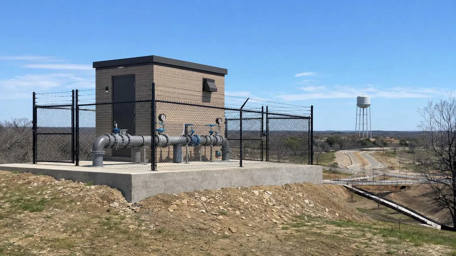
Where a development’s highest elevation areas can’t achieve adequate service pressure and fire flow from the available water source’s pressure alone, a booster pump station, which adds mechanical pressure to lift water to the higher elevation areas at adequate pressure, becomes a necessary piece of infrastructure. Booster pump station sizing requires the same kind of specific hydraulic analysis as the rest of the system, calculating the actual pressure boost needed to achieve adequate service and fire flow pressure at the specific higher elevation area being served, and the flow capacity needed to meet that area’s demand, including fire flow, without over sizing the station beyond what the actual served area requires.
Booster pump stations also introduce their own reliability and redundancy considerations, since a higher-elevation service area that depends entirely on a single booster pump station for adequate pressure has a single point of failure that, if it fails, can leave that area without adequate water pressure or fire flow capability until the station is repaired or a backup measure is activated. Redundant pump configuration within the station, or in some cases an alternative emergency service connection to a different pressure zone, should be evaluated based on the served area’s size and the acceptable risk tolerance for a service interruption, particularly for larger developments where a booster station outage would affect a substantial number of customers or a fire flow critical area.
PRV Vault Design for Lower Elevation Areas
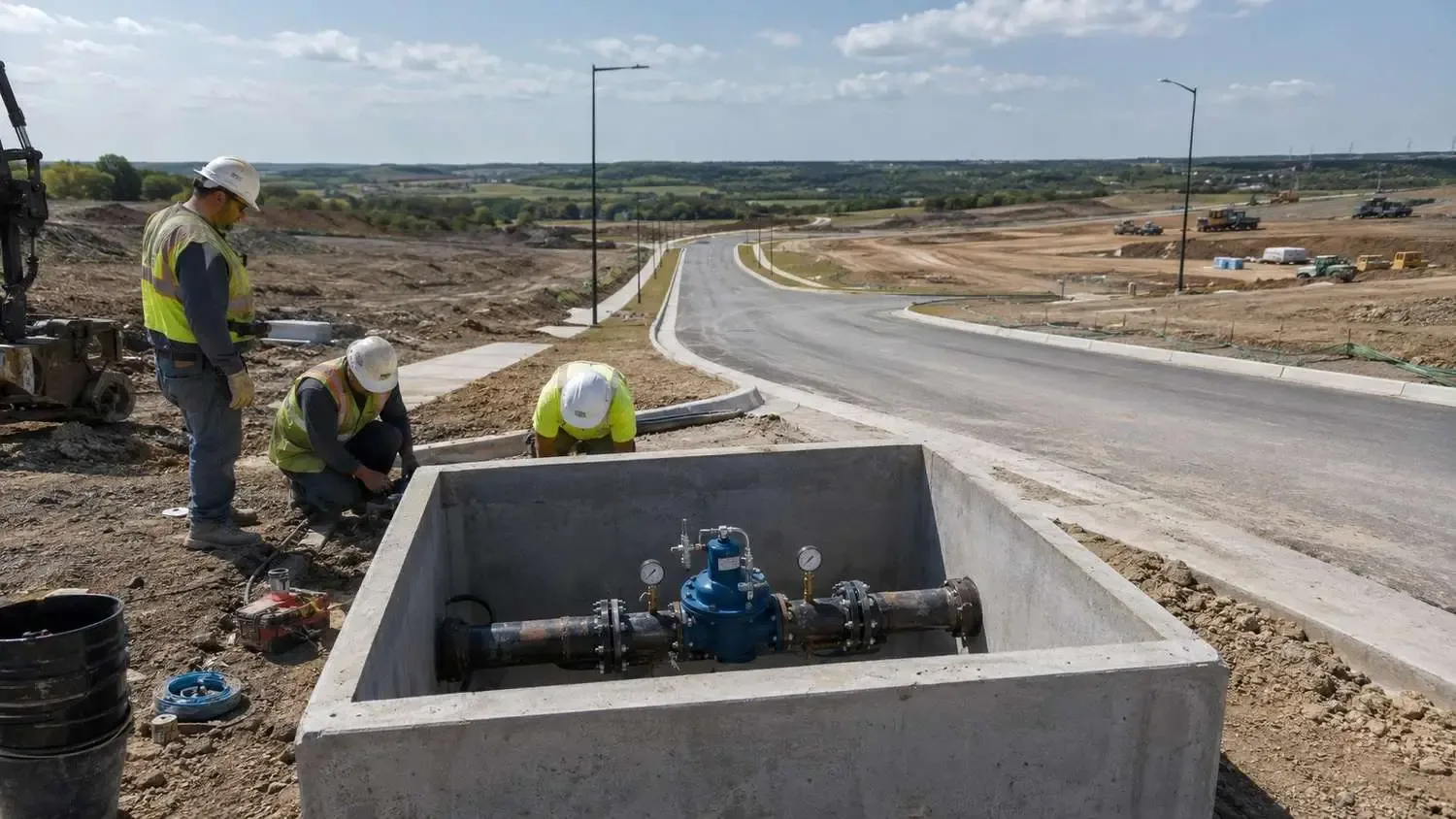
At the opposite end of the elevation range, lower elevation areas within a development that would experience excessive pressure if served directly from a higher pressure zone need pressure reducing valves, typically housed in underground PRV vaults, to step down pressure to an acceptable range before it reaches the lower-elevation customers. PRV vault siting needs to account for maintenance access, since these valves require periodic inspection and maintenance access throughout the system’s operating life, and for the specific pressure differential the valve needs to manage, which affects valve sizing and vault configuration.
A common design mistake in rolling terrain areas is under accounting for how many PRV locations a development’s specific elevation profile actually requires, either by assuming a single PRV can adequately manage a pressure zone transition that actually needs multiple valves positioned at different points to properly manage pressure across a more complex elevation profile, or by failing to identify all the locations within a site where a meaningful elevation drop creates a pressure transition that needs active management rather than passive acceptance. A thorough hydraulic model, evaluated across the site’s actual elevation profile rather than just at a few sample points, is the reliable way to identify every location where PRV infrastructure is actually needed.
Storage Tank Coordination With Pressure Zone Structure
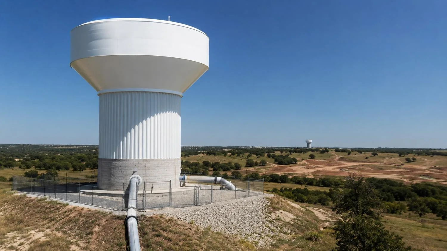
Elevated or ground storage tank siting and the pressure zone it serves need to be coordinated carefully, since a storage tank’s overflow elevation directly determines the pressure it can provide to the distribution system it serves, following the same elevation to pressure relationship governing the rest of the system. A storage tank sited at a specific elevation serves its intended pressure zone adequately only if that elevation relationship has been calculated correctly for the actual zone boundaries and demand the tank needs to support, and changes to a development’s pressure zone structure made after a storage tank site and design have already been established can create a mismatch that undermines the coordinated system’s performance.
For McKinney area developments requiring new storage capacity, whether tank siting is being evaluated as part of a private system or in coordination with the city’s own capital improvement planning for storage serving a broader service area, this elevation and pressure zone coordination should happen as an integrated hydraulic analysis, not as a separate storage siting decision made independently from the pressure zone design work happening elsewhere in the same project.
System Redundancy and Future Development Demand
A pressure zone and storage system designed adequately for a development’s initial demand should also be evaluated against reasonably foreseeable future demand, including planned future phases of the same development and, where relevant, the broader growth the surrounding service area is likely to experience over the infrastructure’s operating life. Undersizing pipe, storage, or booster capacity based only on a project’s initial phase, without accounting for future phases already planned or reasonably anticipated, creates the same kind of costly retrofit risk relevant to phased wastewater system planning, applied here to the water distribution side of the same master planned community’s infrastructure.
System redundancy, meaning the distribution system’s ability to maintain adequate service through a single infrastructure failure, whether a main break, a booster pump station outage, or a storage tank taken offline for maintenance, should be evaluated specifically for higher density or higher value service areas within a development where a service interruption would have a more significant impact, with redundant piping loops, alternative supply connections, or backup pump capacity incorporated where the analysis indicates the redundancy benefit justifies the additional infrastructure cost.
Frequently Asked Questions
How do we know if our specific McKinney development site has enough elevation change to require this level of pressure zone analysis?
A general rule of thumb some engineers use is that elevation changes exceeding roughly fifty feet across a single service area or development site are likely to create pressure variation significant enough to warrant formal pressure zone evaluation, but this threshold isn’t a strict cutoff, and even sites with less dramatic elevation change can present pressure challenges depending on the specific water source pressure, service pressure requirements, and fire flow demand involved. The reliable way to answer this question for your specific site is a preliminary review of your site’s actual topographic survey against the available water source’s pressure characteristics, which can quickly indicate whether more detailed hydraulic modeling is warranted before investing in the full analysis.Does adding a booster pump station or PRV vaults significantly increase our overall project infrastructure cost?
Booster pump stations and PRV vaults do add capital cost beyond what a simpler, single pressure zone system would require, and the magnitude depends on the specific station or vault sizing your site’s elevation profile and demand require. This incremental cost should be weighed against the cost and disruption of discovering a pressure deficiency or over-pressurization problem after construction is complete, when retrofitting a booster station or PRV vault into an already-built distribution system is considerably more expensive and disruptive than incorporating it into the original design.If the City of McKinney’s existing pressure zone map shows our site within a single zone already, do we still need our own site specific hydraulic analysis?
The city’s pressure zone mapping reflects the broader service area’s zone structure but typically doesn’t capture the level of site specific detail needed to confirm your particular development’s internal pressure performance across its own elevation range, particularly for a larger site where meaningful elevation variation exists within what the city’s map treats as a single zone. A site specific hydraulic model, incorporating your development’s actual proposed layout, demand, and detailed topographic survey, should still be performed to confirm internal pressure performance and identify whether any internal pressure management infrastructure, like PRV vaults for a lower area within an overall single city designated zone, is needed within your site even when the broader city zone designation shows no boundary crossing your property.Related Resources
- McKinney Utility Availability Study: What Developers Need Before Submitting a Plat in Collin County’s Fastest Growing City
- Hydraulic Modeling for Dallas High Rise Developments: Why Pressure Zone Design Matters More Than You Think
- Wastewater Engineering for McKinney Master Planned Communities: Sizing Treatment Systems for Phased Buildouts
- Approved Plans Aren’t Always Optimized Plans: The Difference Can Cost $15 Million
Evaluating Pressure Zone and Storage Design for a McKinney or Collin County Development?
MES works with McKinney area developers, municipalities, and utility districts to build site specific hydraulic models, design pressure zone boundaries, size booster pump stations and PRV vaults, coordinate storage tank siting, and prepare water distribution systems that perform reliably across rolling Collin County terrain.
We specialize in:
- Site specific hydraulic modeling and pressure zone analysis for McKinney and Collin County rolling terrain developments
- Booster pump station sizing and design for higher elevation service areas in Texas water distribution systems
- PRV vault design and pressure zone boundary planning for developments spanning significant elevation change
- Storage tank siting and pressure zone coordination for master planned communities and utility service areas
- Fire flow analysis and residual pressure evaluation across variable elevation development sites
- System redundancy and future demand planning for phased water distribution infrastructure in growth corridors
Modern Engineering Solutions, McKinney, Texas. Contact: (214) 833-6748 or mod-eng.com
Keep reading
More to read.
Talk to an engineer
Tell us about your project.
An engineer reads it
Not a salesperson. Someone who can tell you whether the pathway is real.
You get a first answer
Your options, the agencies involved and the questions that decide cost and schedule.
You decide
No commitment to have the first call.
Prefer the phone? (214) 833-6748